What is the ODATIS Ocean Cluster?
The main task of the ODATIS Ocean Cluster is to make available data, products, software, tools and/or services intended primarily for the French scientific community working in the area of ocean research.
Video presentation (in French) of the ODATIS Ocean Data Cluster.
Download here an A0 presentation poster in PDF (in French, translation to English ongoing) of ODATIS
Autres ressources selon différents supports : présentation du pôle Océan ODATIS en 12 diapos, avec son support texte (2026), plaquette format A3 (2025), sous forme d'un poster A0, et webinaires de présentation du pôle Océan ODATIS, en vidéo.
ODATIS (Ocean Data and Services Cluster) helps to describe, quantify and understand the ocean as a whole:
- Ocean dynamics and thermodynamics;
- Evolution of its physico-chemical propreties;
- Biochemical cycles;
- Marine ecosystems functions;
- Ocean evolution and ocean-climate link from the past evolution (paleo-oceanography).
It also covers coastal-specific topics (including estuaries and lagoons):
- Morpho-dynamic evolution of the shoreline;
- Coastline and sea-level;
- Pollutions and eutrophication;
- Coastal ecosystem changes and evolution.

Most of the research carried out by the communities involved in the ODATIS Ocean Data Cluster is the subject of supervised prospectives by the specialized and inter-agency commissions CSOA and CSSIC of the CNRS-INSU, as well as those organized by the CNRS-INEE. They are also the subject of prospective reflection at the level of the Allenvi thematic groups, in particular the groups "Sea and Coastline", "Climate", "Environmental Assessment", "Risks" and "Infrastructure".
This research, together with the associated observation systems, is supported at French level by various calls for proposals:
- Inter-agency programmes: LEFE, EC2CO and PNTS, coordinated by CNRS-INSU;
- CNES TOSCA programmes;
- ANR programmes;
- Basic support from organisations to national accredited observation services (SNO);
- Local and regional support to SNO;
- Basic support to the MENESR observational federative infrastructure via Allenvi and research operators (SOERE, IR, TGIR).
The data and products of ODATIS - Ocean Data Cluster - must also contribute to the implementation of public policies (in particular the MSFD), as well as to the development of the national socio-economic environment.
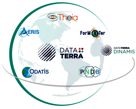
Therefore, based on the final report of the working group created at the initiative of the CNES and CNRS-INSU, national research organizations agreed (at the end of 2013) to set up four national data clusters for coordinated management and centralized access to data. Each of this clusters correspond to a major compartment of the Earth system (solid Earth, ocean, continental surfaces and atmosphere):
- FormaTerre : solid Earth;
- ODATIS : oceans;
- THEIA : continental surfaces;
- AERIS: atmosphere;
- PNDB: biodiversity
These five data clusters are grouped in the Earth System Research Infrastructure (RI), called Data Terra. The RI Data Terra appears on the roadmap of the research infrastructures of the Ministry of Higher Education, Research and Innovation (Research Infrastructure Roadmap 2018, Edition 2, pdf link). The National Biodiversity Data Centre (PNDB) will be in strong collaboration with Data Terra and its four data clusters.
The main task of the four clusters (ODATIS, AERIS, FormaTerre, THEIA and PNDB) of the RI "DATA TERRA" is to provide access to data, products, software, tools and/or services intended primarily for the French scientific community for the purposes of its research on the Earth system. The information offered by the data clusters is also fundamental for implementing public policies. By providing a better understanding of the structure and functioning of the Earth system, work using this data has a significant socio-economic impact in areas such as natural hazards, climate change, mineral or water resources. In this context, the clusters also serve the international community (satellite missions, international monitoring networks and partnerships for development).
The Data Terra RI's data clusters are intended to be part of the national and European landscapes in close coordination with the infrastructures in place and under construction. The organisation as a single structure will strengthen the position of the French community in the European landscape and in particular in the development of e-infrastructures.
The definition of the scientific objectives of the clusters reflects the needs expressed by the underlying related scientific community (scientific prospective CNRS-INSU, Allenvi thematic groups, organizations' prospective). Public policy needs are also taken into account.
Each cluster aims to facilitate access to satellite, airborn and in-situ (ground) data acquired and managed by research laboratories, distributed structures (OSUs, FRs, etc.) or national infrastructures such as the National Monitoring Services (SNOs), SOEREs, the oceanographic fleet, airplanes and space missions.
At national level, the data clusters combine or supplement a set of activities that previously existed either within infrastructures or more diffuse (informally). They bring together scientific disciplines related to a terrestrial compartment, offer value-added services and products, provide scientific expertise, promote the tools and methods developed within the relevant French scientific research community. As a result, products in the broad sense thus become more visible and each data cluster, as a whole, becomes more effective through the pooling of experiences and means. The coherence of the four clusters (ODATIS, AERIS, Form@ter & Théia) and the Data Terra RI (Research Infrastructure) adds additional scientific value and facilitates coordination with other disciplines.
Disseminate and secure
- Ensure sustainability and facilitate the collection of heritage data;
- Facilitate the exploitation of the information contained in databases:
- Technical and semantic interoperability (harmonisation);
- Common portal (tools for exploration, visualization, extraction, analysis).
Generating and inventing
- Promote the combined use of different data (satellites, in-situ, offshore campaigns);
- Develop by combining different datasets;
- Overcoming spatial, temporal and disciplinary boundaries;
- Produce data series that are qualified and described in accordance with current recognized standards (level 2 and +).
Train and inform
- Provide support and expertise to users;
- Participate in the scientific, methodological and technical training of the communities;
- Contribute to the positioning and promotion of French skills at the European and international level.
The clusters are committed to providing and producing, under the responsibility of experts, qualified and described data sets, in order to allow their use and reuse in accordance with the highest standards in force. The scope of the data managed by the ODATIS Ocean Data Cluster is described on the Services to data producers page.
The meta-data, included in the ODATIS catalogue, are available in the European standard INSPIRE; they appear in the form of data sheets in national geocatalogues and geoportals. Data from a global database will conform to the formats recommended for that database.
In general, the data and meta-data managed and produced are intended to be public. However, some data may be subject to restrictive licenses, limiting the use by third parties. The "Interpôles" working group, including the Ocean Cluster ODATIS, encourages the implementation of the Creative Commons licence determining the conditions for the reuse of data while providing legal certainty to the authors of these data.
The Data Terra Research Infrastructure's clusters encourage the use of DOIs (Digital Object Identifier) to identify data sets, requiring their users to cite them, and thus opening up bibliometry perspectives for the infrastructure.
To facilitate the exploitation of the information contained in the databases, the Clusters will provide tools for exploration, visualization, extraction and analysis as well as the appropriate means of calculation.
The Data Clusters ensure the sustainability of heritage datasets and facilitate their collection. They have the preservation capacities for some of their data, for others they will use the national archiving centers (ex: CINES), dedicated structures such as the Earth Science and Astronomy Observatories (OSU) or specialized organizations (CNES, Météo-France, Ifremer). Long-term archiving of unique databases will be ensured.
The challenge is therefore to define common bases for all data producers and to make the datasets interoperable so that their resources are coherent, shareable, usable and that in a multidisciplinary approach required to study the Earth system, that the data could be combined with each other. In this sense, the Ocean Cluster ODATIS offers several services to data producers and accessible on this site.
Finally, the Cluster host collaborative platforms for sharing documentation, best practice guides and information on scientific and technical activity associated with observations.