News
Observing the Sargassum from space

A pelagic seaweed proliferating since 2010
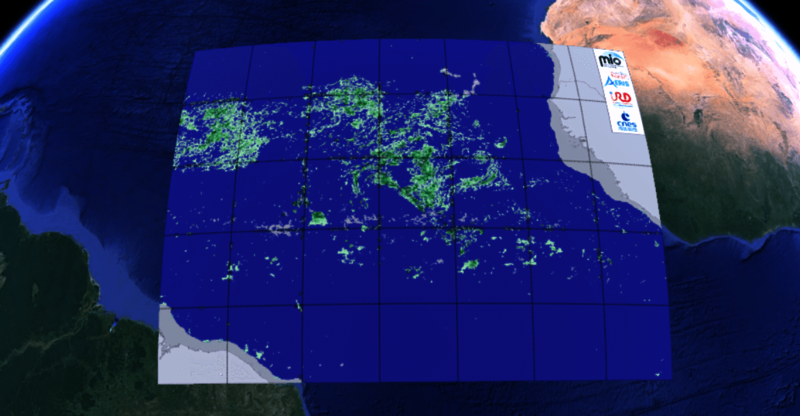
Sargassum are pelagic brown seaweed, floating in long patches at the ocean surface, strechching from several tens to hundreds of metres long and a few metres thick. These patches assemble into larger structures, often elongated in shape and several tens to hundreds of kilometres long, capable of being detected from space. These patches drift at the ocean surface, accumulate in areas of convergence and can become very large when they reach the coasts (Caribbean, Brazil, West Africa). Near the coasts, the biodiversity of shallow waters and beaches, economic and tourist activities are strongly impacted. The gases released by the decomposition of the Sargassum also have health consequences for people.
Since 2010, the area distribution and biomass of these seaweed have been modified. They are now found further south, in the tropical Atlantic, close to an equatorial strip of 5°N with much higher biomasses. These variations and their consequences have motivated several studies to understand the context of their expansion and their interannual evolution.
Climatologies and operational production
Within the framework of the SAREDA project (Sargassum Evolving Distributions in the Atlantic), supported by TOSCA-CNES and IRD, the MIO has partnered with the AERIS cluster and its ICARE data and services centre specialised in the massive exploitation of Earth observation spatial data, for the processing of data with a spatial resolution of 1 km and over a time series of more than 20 years, since 2000.
This processing chain produces daily and monthly maps based on images from the MODIS radiometers set on NASA's Aqua and Terra satellite missions. These maps are based on the calculation of the AFAI radiometric index (Alternative Floating Algae Index), combining several reflectances of different wavelengths allowing the identification of Sargassum at the surface.
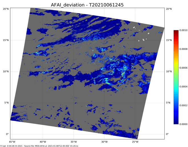

This climatology over the [2002-2020] period is disseminated via the ODATIS Ocean Centre. A quasi-real-time data set is also planned, the operational production currently being transferred to Météo France's Space Meteorology Centre.
Sargassum observation is continuing within the framework of the FORESEA (Forecasting seasonal Sargassum Events in the Atlantic) project (2020-2022) funded by the ANR, the Guadeloupe Region and the Territorial Community of Martinique, which aims to develop a seasonal sargassum forecasting system.
Further information
- on Data Terra website: Le spatial au service de l'étude des sargasses en mer
- on AERIS website: AERIS takes part in the Sargassum chase
- on FORESEA website: presentation of Forecasting seasonal Sargassum Events in the Atlantic project
Access to the data catalogue